https://www.google.com/maps/search/matangi+village/@-37.8005508,175.3577261,13z/data=!3m1!4b1
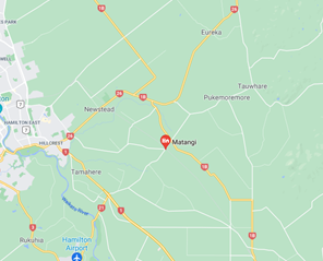
It has been a disappointment and frustration for some residents over several years that many maps did not recognise Matangi as a location or a community. With the help of Waikato District Council and Fire and Emergency changes have been made and have now also been approved and implemented by Google which will show Matangi on their maps as an area and a settlement.
As there are many mapping tools and adaptations by users it may take a while for the change to be seen everywhere.
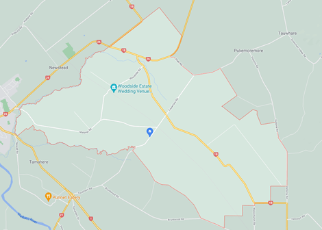
The community map used was provided by Waikato District Council and shows that the Matangi community is part of 2 Council wards – Tamahere and Eureka.

That is great news. Having lived in different parts of Matangi over the last 25 years or so we have found it very confusing that the Matangi identity wasn’t recognised!
LikeLike